


Geographic Information Systems & Mapping
At its core, GIS combines geography with information technology to help us understand patterns, relationships, and trends in the world around us. By linking data to specific locations on Earth's surface, GIS transforms ordinary databases into dynamic, visual tools that reveal insights impossible to discern from tables and numbers alone.
Whether it's tracking wildlife migration patterns, planning urban development, managing natural resources, or responding to emergencies, GIS provides the spatial context that turns raw data into actionable intelligence.
Maps are critical to your business.
Make data-driven decisions.
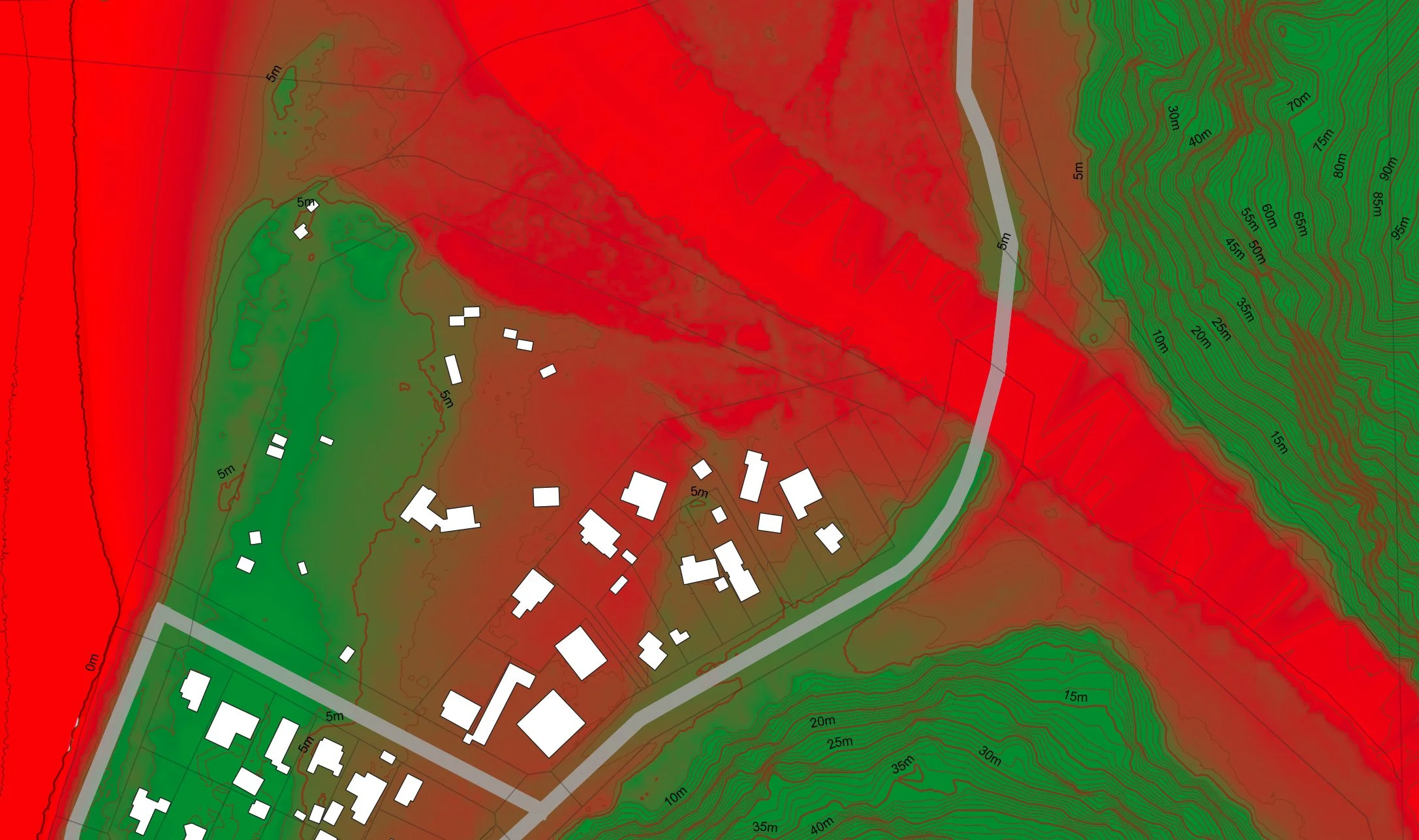
Natural hazards – flood inundation
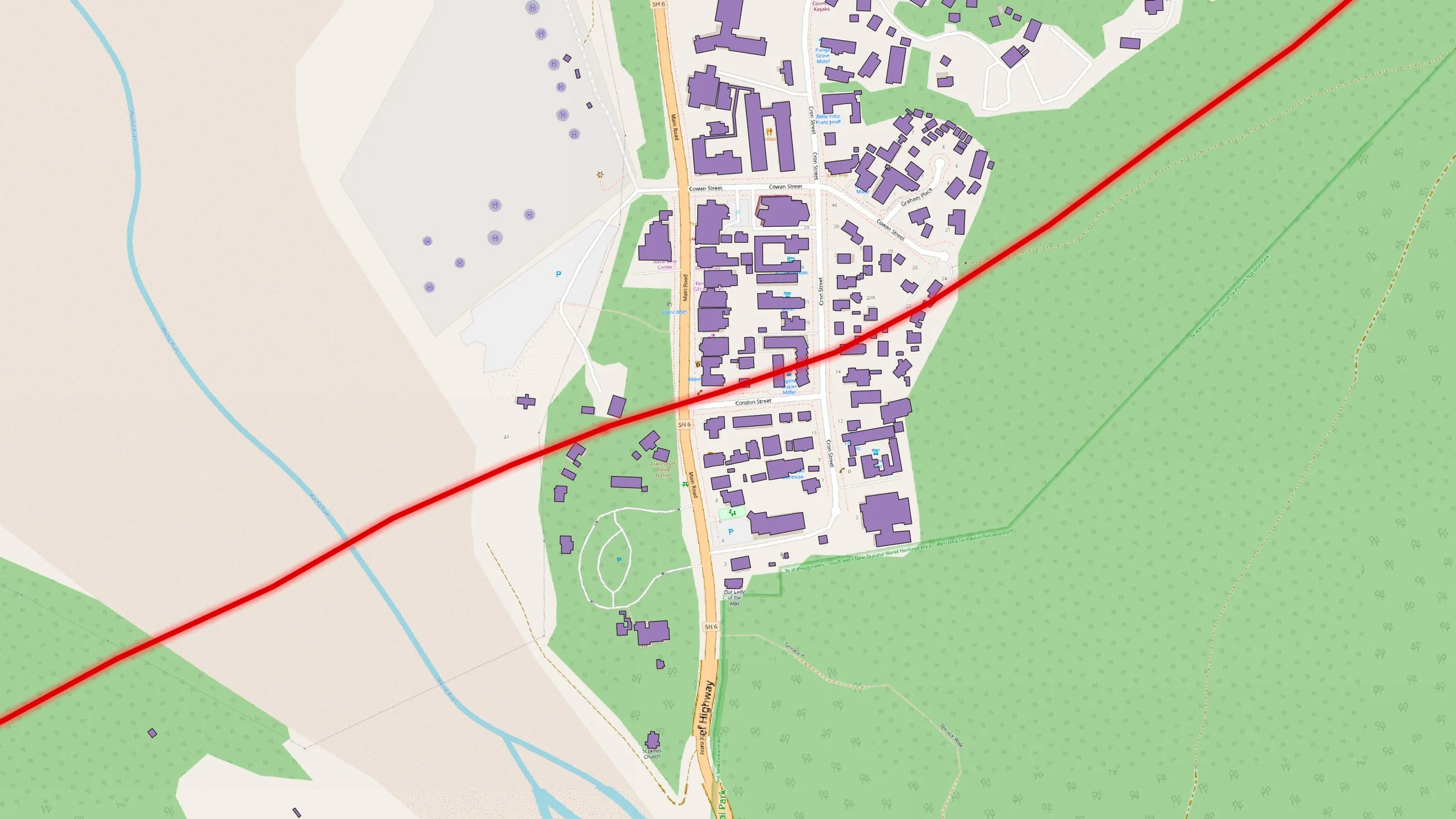
Natural hazards – Alpine Fault trace

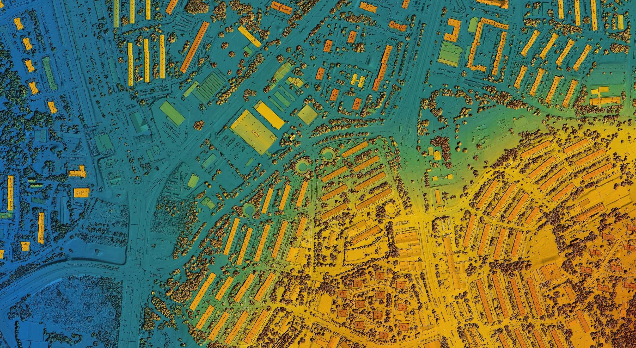
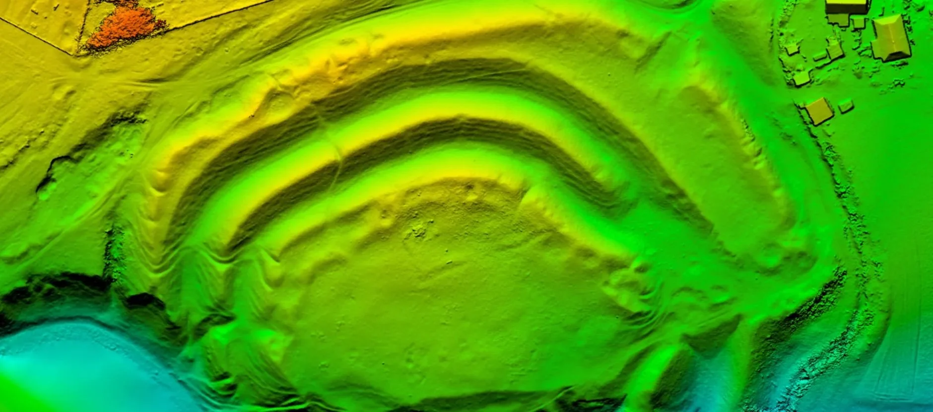
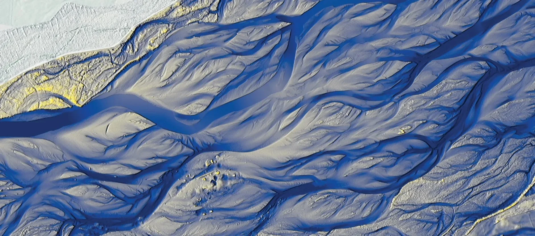
Lidar + 1 meter contours
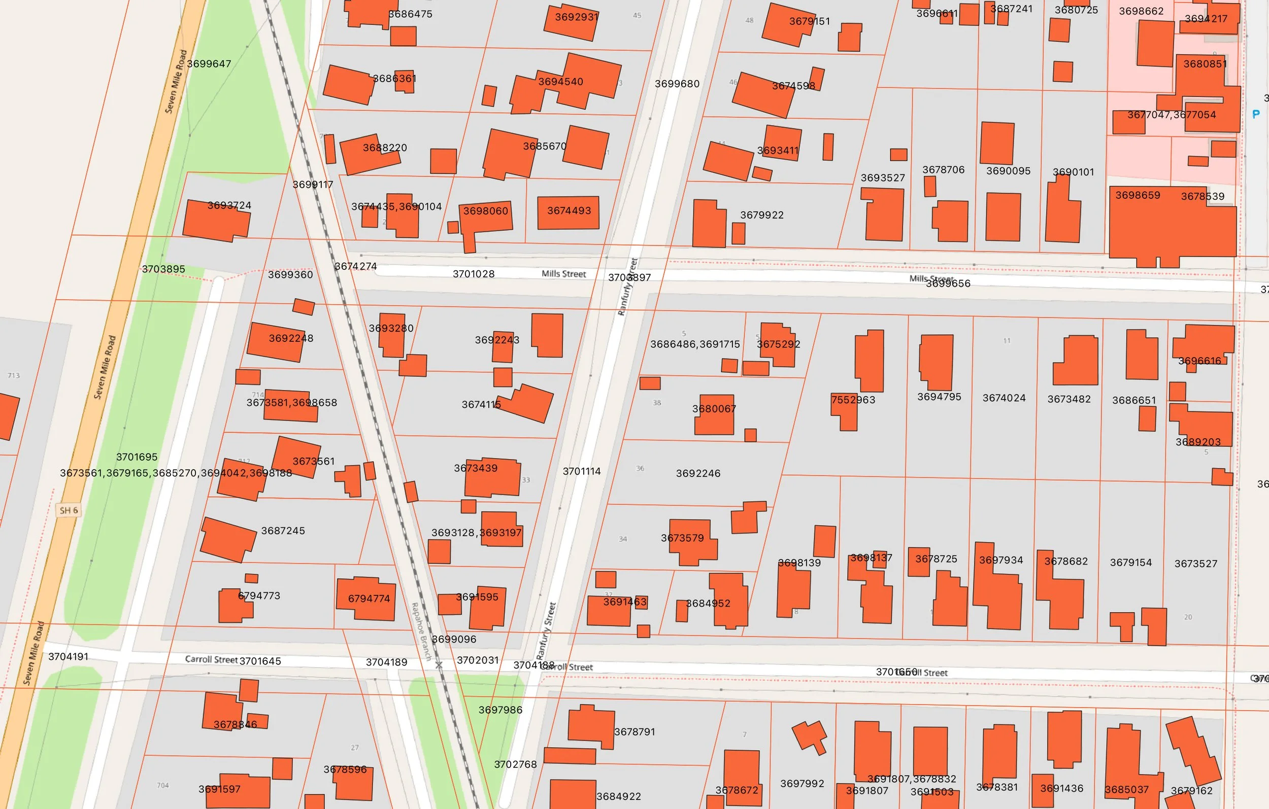
Property boundaries + building outlines

Project location overview
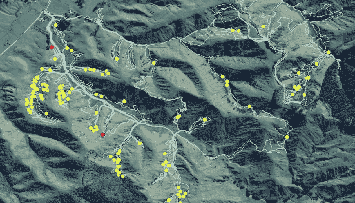
Slope hazard analysis
LIDAR contours
Earthquake Fault traces
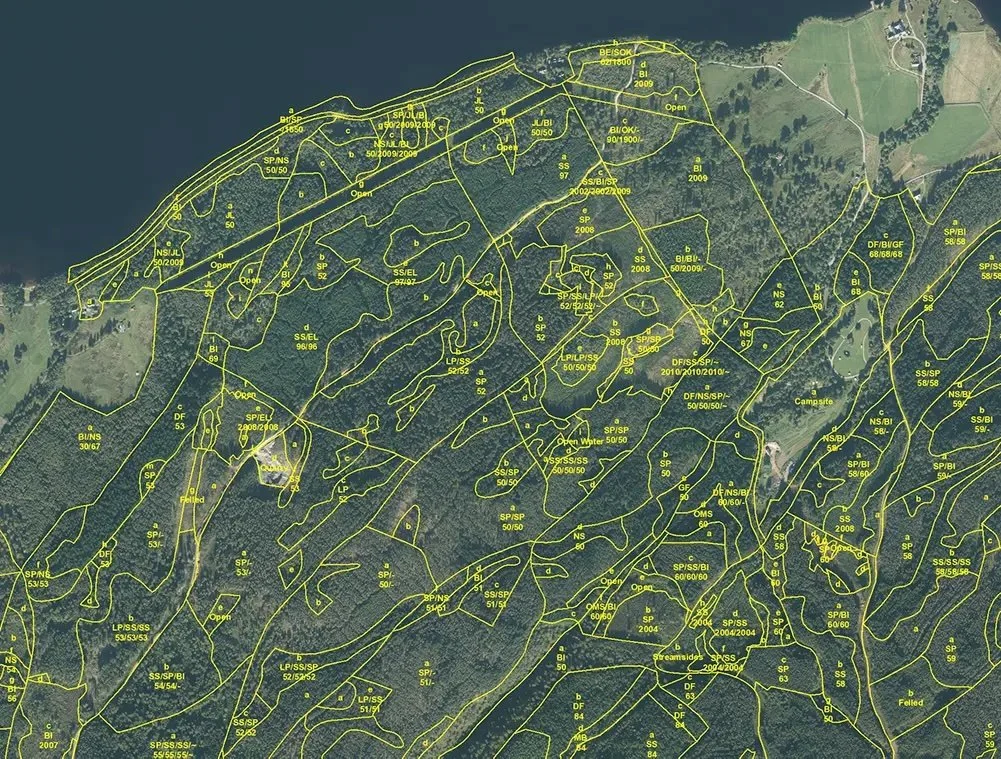
Vegetation cover
Census data
Mine site overview and planning
Mineral core sample heatmaps
Traffic movements